
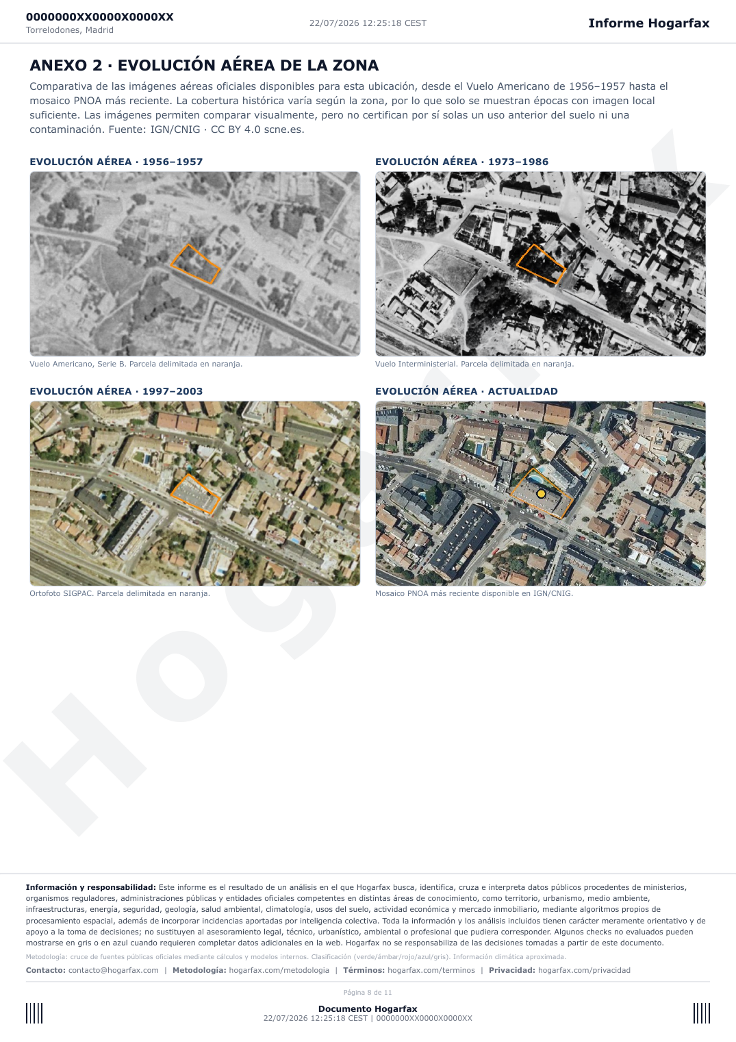
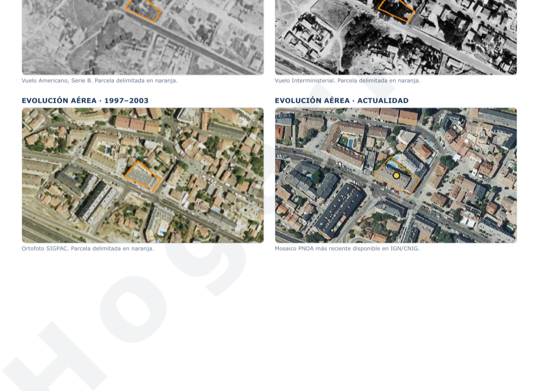
A current photo shows how an area looks. Historical aerial imagery helps explain how it got there. Hogarfax now adds an official orthophoto-history annex to the property-report PDF, comparing the real imagery available for each location from the 1956–1957 American Flight to the latest PNOA mosaic.
See your property's aerial history
Enter an address or cadastral reference. Start free and unlock the complete PDF report for €24.90 (VAT included).
Analyse my propertyWhat is historical aerial imagery?
An orthophoto is an aerial photograph geometrically corrected so it can be placed on a map. Comparing dates with the exact cadastral plot outlined lets you see changes in buildings, roads, crops, vacant land, woodland, water and density. These are not AI reconstructions: they are official flights served by Spain's National Geographic Institute and CNIG.
Which historical periods can appear?
- 1956–1957 · American Flight, Series B: the oldest aerial reference available for much of mainland Spain and the Balearic Islands.
- 1973–1986 · Interministerial and National Flights: useful for comparing the urban and rural expansion of the following decades.
- 1997–2003 · SIGPAC and OLISTAT: an intermediate view of new estates, roads and land-use changes.
- Present day · PNOA: the latest official aerial mosaic available from IGN/CNIG.
The important word is available. Historical coverage is not identical across Spain. If a flight does not cover the point sufficiently, Hogarfax does not invent a fourth date or substitute an unrelated year: the annex shows only the periods with real local imagery.
What can you spot before buying?
- Whether the plot was empty, agricultural or already built on in an earlier period.
- Whether roads, estates, industrial buildings or other infrastructure appeared nearby.
- Whether visible changes raise a question for the seller or the town hall.
- Whether vegetation, construction or the current listing photo hides important context.
Official source and method
The imagery comes from the IGN/CNIG Historical PNOA service. Hogarfax requests each WMS layer, crops it around the exact cadastral geometry, checks that enough visible imagery exists and draws the plot boundary for comparison. The report identifies the period and preserves the source attribution.
The service is published under CC BY 4.0 scne.es. See the official PNOA web services page and the Historical PNOA WMS capabilities.
Aerial history, price and risk in one decision
Aerial evolution does not replace a property-risk report: it completes it. A serious buying decision combines the exact plot, land classification, flood, radon, wildfire, surroundings, floor-area discrepancies and the area's real price. That is why the historical annex sits inside Hogarfax's professional PDF, alongside current aerial scales, cadastral mapping and detected-impact maps.
Do not buy on the listing photo alone
Check what surrounds the property and what was there before. The initial exploration is free; the complete PDF report costs €24.90 (VAT included), one payment.
Generate my property reportFuentes
pnoa.ign.es/web/portal/pnoa-imagen/visualizadores-y-servicios-web
www.ign.es/wms/pnoa-historico?Request=GetCapabilities&Service=WMS
Was this article useful?
Your answer helps us improve the blog and understand which guides deserve more depth.