
A foreign buyer wanted to purchase a plot in Oviedo (Asturias) to build on. On paper, everything fitted: a plot of around 2,908 m², classified as urban land in the Cadastre, with the use «development and gardening works, unbuilt land». Not a single red flag at first glance. Then they ran the plot through Hogarfax, and the 24.90 € report completely changed the decision.
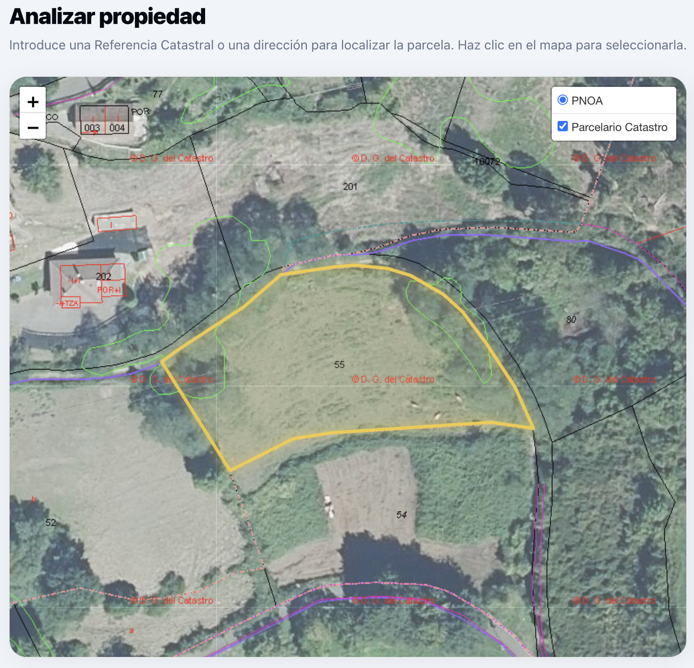
This is a real case (anonymised). We tell it because it sums up, better than any marketing argument, why looking only at the listing —or only at the Cadastre— can prove very costly. The report revealed three things that appeared nowhere: one in physical risks and two in land-use limitations. Let's take them in order.
First signal: an area with potential radon
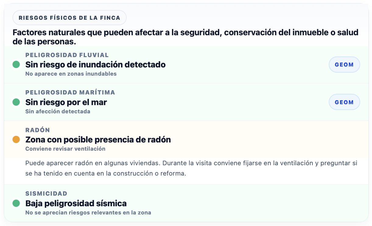
The report flagged «Area with potential radon presence». It is not a condemnation —Asturias is one of the highest radon-potential areas in Spain due to its granitic geology— but it is a concrete warning: when building, you will have to apply the radon protection measures required by the Spanish Building Code (CTE, DB HS6). That is cost and design to plan for from the project stage, not to discover afterwards. We explain it in depth in the guide to radon risk in Spanish homes.
The serious alert: «very limited use» of the land
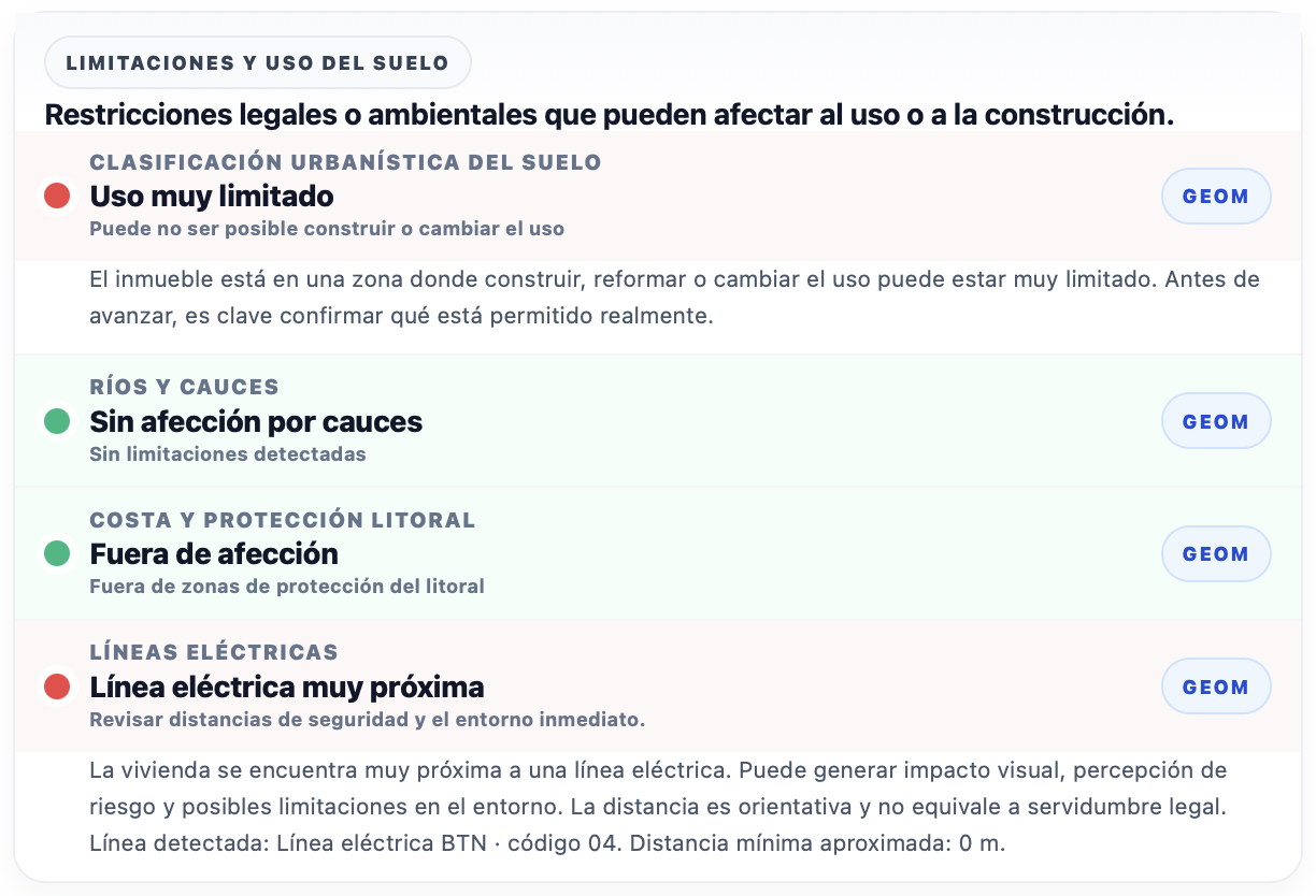
This is where the serious alert appeared. The urban classification showed in red: «Very limited use — building or changing the use may not be possible». The check crosses the plot's exact geometry with the Urban Information System (SIU) and calculates the percentage of each land class. The result: the predominant class over the plot (≈75%) is not buildable urban land. In other words, the Cadastre said «Urban» flatly, but the cross-check with planning revealed that on most of the plot, building could be heavily restricted.
For someone buying precisely in order to build, this changes everything. Understanding the difference between what the Cadastre says and what planning says is exactly what we cover in land classification and the SIU in Spain.
The interactive viewer: see it on the map, don't just take our word
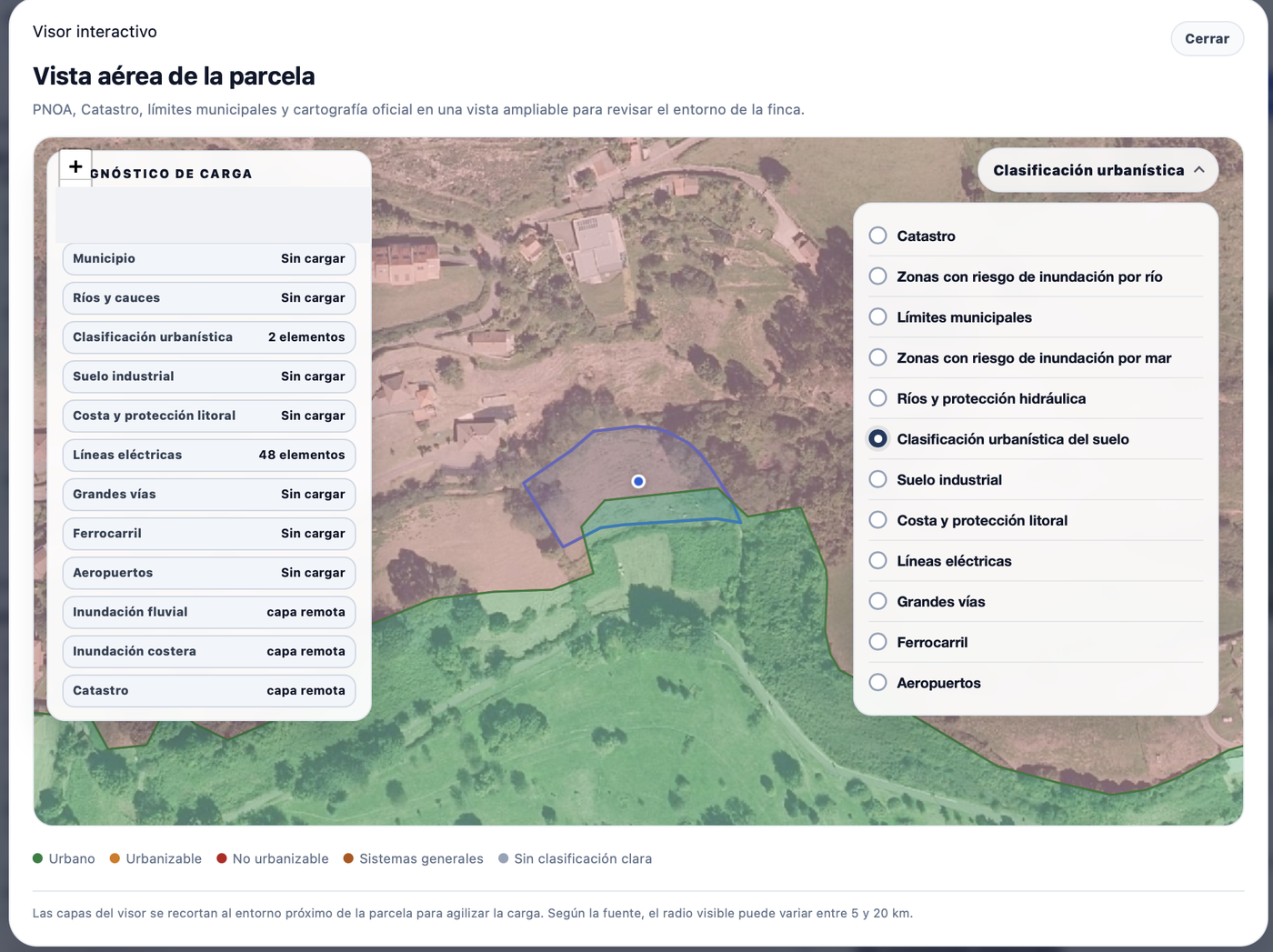
And here is, for us, the most important part. Hogarfax does not just give you a line of text saying «limited use» and ask you to trust it. It gives you an interactive viewer where you overlay the official layers on the aerial photo (PNOA) —Cadastre, urban classification, power lines, rivers, coast, river and coastal flooding, municipal boundaries, major roads, railways, airports— and see with your own eyes exactly what affects the plot and where. Here, switching on the land layer, you can see that the plot outline falls mostly in grey «no clear classification» and only a band touches the green «urban».
And on top of that, a power line crossing the plot
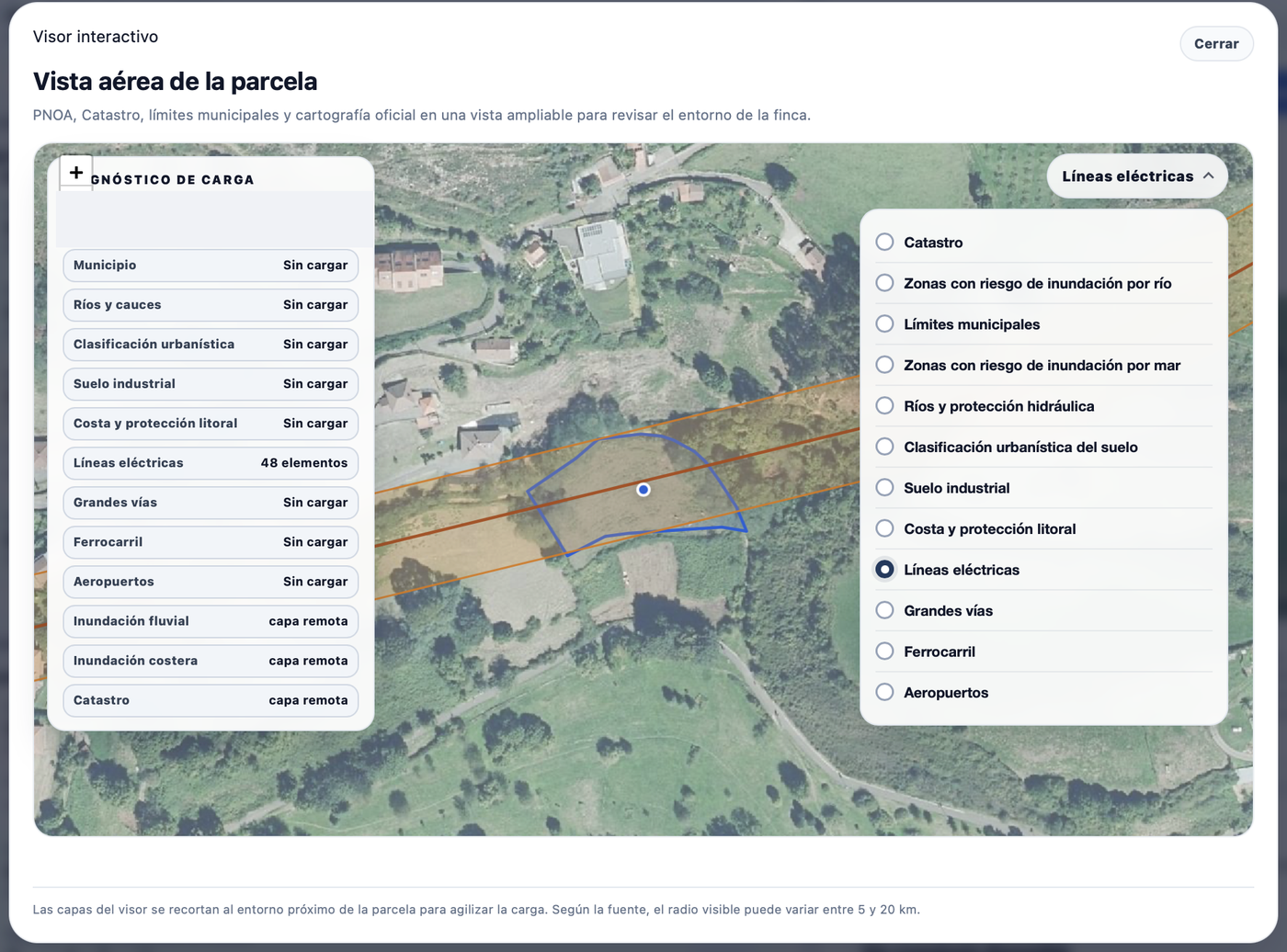
The third alert: «Power line very close». The report detected a power line (BTN, code 04) at a minimum distance of approximately 0 metres. Opening the corresponding layer in the viewer shows why: the line crosses the plot down the middle. Visual impact, risk perception and possible limitations in the immediate surroundings, right where building would make sense. More context in high-voltage power lines near a home in Spain.
24.90 € to avoid several nasty surprises
Let's add it up: a plot that in the listing and the Cadastre looked like urban land ready to build on turned out to have a radon area (mandatory CTE measures), a «very limited use» urban classification over ~75% of its surface and a power line crossing it. Either of the two land limitations could, on its own, sink the plan to build the home. The buyer learned all this before signing and spending on notary, taxes and design, for 24.90 €.
- Rigour: each alert comes from crossing the plot's exact geometry with official sources (Cadastre, SIU, power-line mapping), not from an estimate.
- Precision: the analysis is per plot, not per municipality; it distinguishes what % of your land is affected, not a generic label.
- Verifiability: the viewer lets you check each affection yourself on the official map. It is not a text to be believed, nor an AI answer that can be made up.
- In time: all of this before the deposit contract, when you can still walk away or renegotiate.
Check the plot or home before you buy
Enter the address or cadastral reference and cross radon, land classification, power lines, flooding and more on the official map. For 24.90 €.
Analyse the propertyFuentes
www.mivau.gob.es/urbanismo-y-suelo/sistema-de-informacion-urbana
Was this article useful?
Your answer helps us improve the blog and understand which guides deserve more depth.